
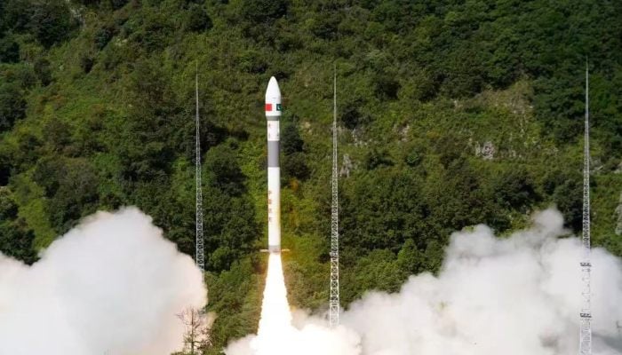
Pakistan on Thursday launched advanced Remote Sensing Satellite from the Xichang Satellite Launch Center (XSLC) in China.
The Pakistan Space and Upper Atmosphere Research Commission (SUPARCO) has made the announcement, calling it a landmark development in Pakistan’s pursuit of space technology, promising to dramatically expand Earth observation capabilities.
The satellite is equipped with state-of-the-art imaging systems and it will support a range of national applications — from precision agriculture and urban planning to environmental monitoring and disaster management.
Its role will be vital in predicting and mitigating the impacts of floods, earthquakes, landslides, glacier melt, and deforestation, while enabling informed decisions for resource management.
The satellite will also assist in infrastructure planning and geospatial mapping under national development programs such as the China-Pakistan Economic Corridor (CPEC).
With its integration into Pakistan’s existing space fleet — including PRSS-1 (2018) and EO-1 (January 2025) — the new satellite strengthens SUPARCO’s capabilities and aligns with the goals of the National Space Policy and Vision 2047, positioning Pakistan to emerge as a forward-looking, spacefaring nation.
In 2024, PakSat-MM1 brought high-speed internet to underserved areas, while the launch of iCube Qamar, a student-built satellite from the Institute of Space Technology (IST), captured stunning images of the lunar surface, showcasing the innovation and promise of Pakistan’s young scientists on a global stage.
Most notably, in January 2025, Pakistan launched its first fully indigenous satellite, Electro-Optical Satellite EO-1, developed entirely by Pakistani engineers and scientists.
Related Posts


