
China has introduced a series of cutting-edge geological exploration technologies, marking a major leap in deep-Earth, marine, and space-based resource research. Featuring automation, intelligent control, and hyperspectral imaging, these advancements strengthen China’s capabilities in mineral exploration, geophysical studies, and environmental monitoring.
Revolution in Deep-Earth Exploration
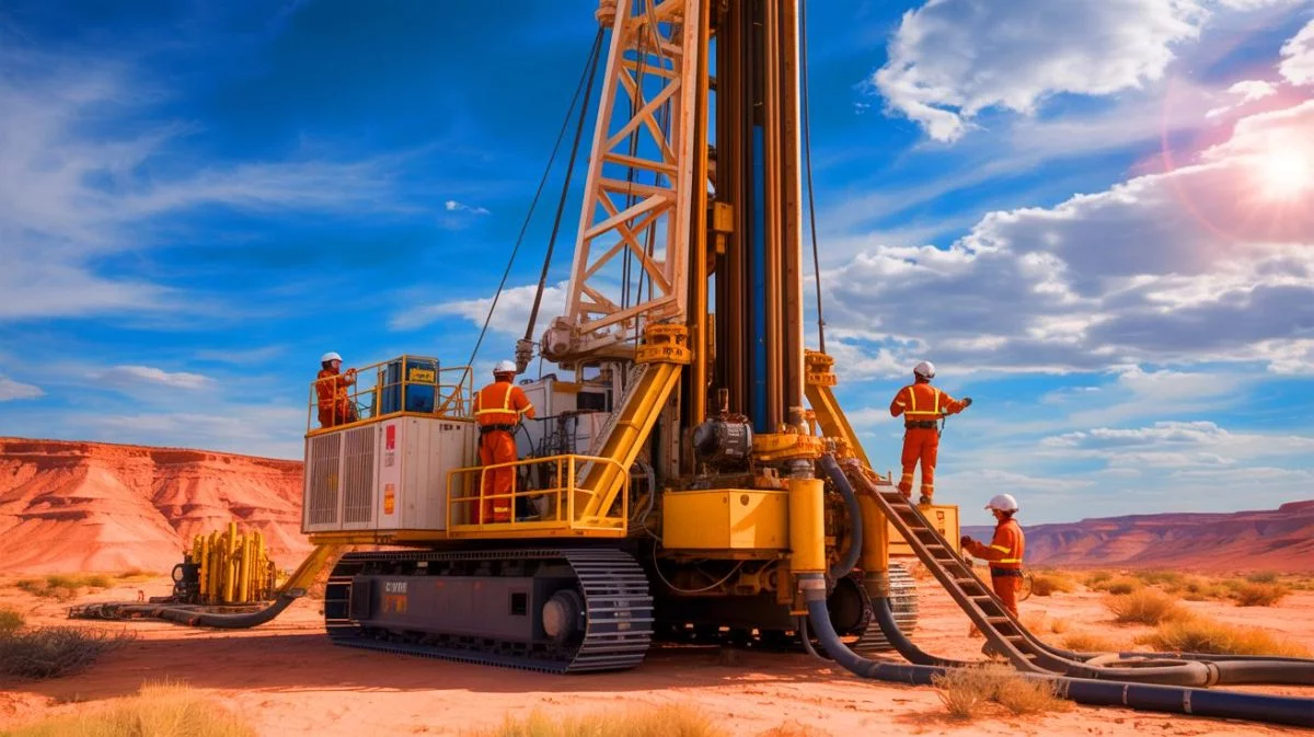
One of the most significant innovations is the 5,000-meter intelligent geological drilling system. This advanced technology automates up to 90% of wellhead operations. Through breakthroughs in intelligent control, lightweight modular design, and automation, it allows high-precision deep-Earth exploration. Moreover, it supports industrial innovation and helps accelerate China’s deep-resource development.
China’s First Hyperspectral Geological Satellite
In the field of space technology, the Geology 1 Hyperspectral Small Satellite represents another major step. Launched on May 17, it is China’s first satellite dedicated entirely to geological research. Orbiting 520 kilometres above Earth, it uses hyperspectral imaging to detect and analyse geological and environmental features with exceptional precision. Consequently, it enhances resource mapping, mineral monitoring, and remote sensing capabilities.
Lightweight Airborne Gravimeter Expands Research Frontiers
The GIPS-1A Lightweight Airborne Gravimeter adds flexibility to geological research. Compact and adaptable, it can be mounted on drones, ships, or submersibles to measure local gravity anomalies. Its small size, high precision, and environmental adaptability make it useful across multiple disciplines, from resource exploration and geodesy to marine science and defence applications.
Drones Power Ground-Airborne Exploration
The Ground-Airborne Transient Electromagnetic System integrates drone-based data collection for mineral exploration and geological hazard detection. Using unmanned systems eliminates traditional limitations in deserts, mountains, and rainforests. This innovation, tested successfully in Guizhou and Xinjiang, significantly improves efficiency and data accuracy in remote regions.
Deep Insights from Ocean-Bottom Seismometers
For marine studies, the Multiband Intelligent Ocean-Bottom Seismometer, developed by the Guangzhou Marine Geological Survey, provides critical insights into subsea structures. Deployed on the seafloor, it records seismic wave signals to create detailed geological maps. This technology plays an essential role in marine resource exploration, earthquake studies, and subsea carbon storage.
Mobile Field Testing Enhances Efficiency
On land, the Field Rapid Analysis and Testing Platform provides on-site, lab-quality testing for geological and environmental surveys. Mounted on specialised vehicles, it can analyse 69 major and trace elements using hyperspectral tools. Since 2023, it has operated across mountains, deserts, and rainforests, cutting down exploration time and supporting eco-friendly fieldwork.
“Meng Xiang”: China’s Deep-Ocean Drilling Vessel
At sea, the Deep-Ocean Drilling Vessel Meng Xiang stands as a symbol of China’s growing marine capabilities. Measuring 179.8 meters long with a 42,600-ton displacement, it can drill up to 11,000 meters below the ocean floor. Designed to withstand level-16 typhoons, it operates autonomously for up to 120 days. The vessel combines scientific drilling, deep-sea oil and gas exploration, and gas hydrate testing, positioning China as a global leader in marine geological research.
Advancing Global Collaboration in Earth Sciences
Together, these technologies highlight China’s expanding leadership in intelligent, automated, and sustainable geological exploration. They also reflect a broader vision, advancing scientific collaboration and innovation for the shared study of Earth and marine systems worldwide.
Related stories:
China-Pakistan Joint Marine Geological Survey Data handover ceremony held in Beijing


